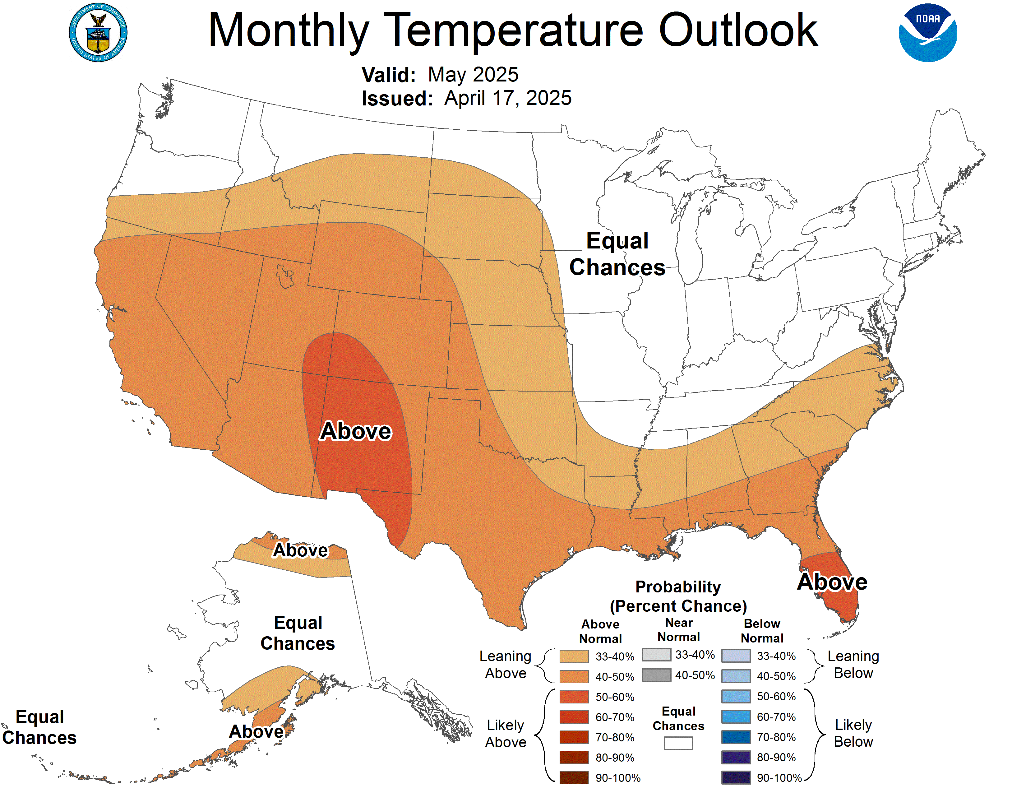
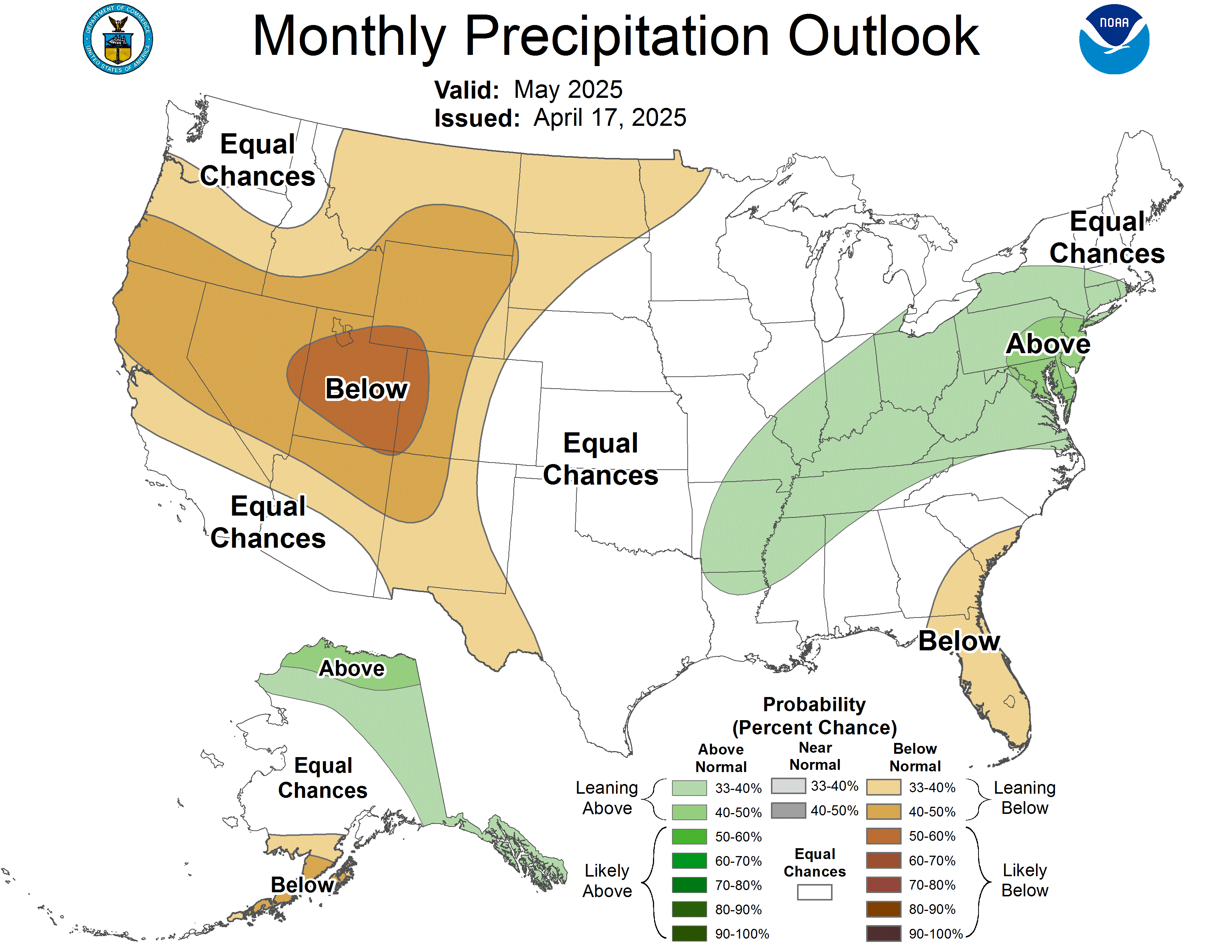
Today the NWS issued its mid-month outlook for next month for the region. I'll get into that later on. For Indiana last month they called for Above Normal Temps and Above Normal precipitation for this current month of January. The Actual average high temp in January so far for the first 18 days is 42° which should typically be 35°. The Average Low during same period now is 24°, which should be 20°. The avg mean temp so far for the month of Indianapolis is 32.7°. I'd say they were close to their prediction so far at this point going off Avg High.
As for precipitation, they called for Above Normal Precip. We are a little bit behind the numbers. We had a stretch of dry sunny days from Jan 3-10, recorded only a trace of snow on the 14th, and dry and sunny for the 15th and 18th. So 10-11 days out of 18 we've been dry and sunny.
We should average 2.66" of precipitation for the month of January. This could be rain, freezing rain, sleet, or ice. So far we stand at 1.53". We do have 11 more days left of the month a few rain chances also before the month closes out to add the current numbers. Last year, 2.2" precip.
Our avg snowfall for the month of January should be 8.6". Currently we stand at 3.2". Last year, 11.8" was recorded. We are currently behind on both snowfall and precipatation. When the NWS issues these precip outlook maps, any form of precipitation including snowfall is rolled all into one map. So like I said, this prediction is currently off. We still have 11 days left to go, anything can change.
Here we go, next month what can you expect? Well as seen in the maps below, Central Indiana should expect Above Normal Temperatures and Above Normal Precipitation.
Lets first breakdown the February temps. We avg a high of 40° and a low of 24° and mean temp of 32°. Last year, our avg high was 42°, avg low 25°, mean temp 33°. We had a range of temps last year from lows as low as -1° (Feb 10) to highs as high as 66° (Feb 28).
Now you know where the temps stand for Feb. Lets talk precip/snow.
The avg rainfall (sleet or ice) for the month is 2.32". Last year we recorded 5.25". Avg Snowfall is 6.5", we recorded 7.5" last year. So we were definitely above normal with precipitation last year. Question is..how about Feb. this year?


Here's my take:
Feb 1-5 we'll start off mild. I think we'll have a better chance at rain then snow. If we get any snow, definitely on the light side.
Feb 5-10 I think the topsy turvy trend will continue. We'll have a few blast of artic air interrupting mild weather pattern
Feb 10-28-I think we'll begin to see some stormy patterns develop. A few thunderstorms and perhaps our real big significant snow storm.
By March, i think winter will be upon us for the beginning of Month but after maybe the first week, we'll be back on a January repeat.
Weather is hard to predict because patterns are always changing and taking different courses. Meteorologists runs numerous models to aid their predictions. Some are in alignment, others, way off course. It really comes down to their knowledge and expertise. They use their experiences to help them predict the forecast so we can better plan short-term and long-term scheduling.
I admit, I am a newbie in the meteorology field. In fact, I don't have the schooling and certifications either but follow it very closely
I created this blog as a reference. To outline statistics in past weather observations and compare and contrast future predictions. I hope this blog has been helpful. I know my February predictions could be way off key especially considering my background. Please DO NOT expect this to come true but I just sort of wanted to guess-timate and give some insight on what I think will personally happen. I'm curious to see where February takes us. After all, Its still winter and winterly things can happen at any time of the month. You don't have to be a certified Meteorologists to know that!
No comments:
Post a Comment