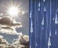
TODAY/TONIGHT
Some morning showers put an end to a 10 day dry streak, longest of the year. The low temp went down as 60°. There was a few spotty showers throughout the day but most areas were rather dry in between weather systems. Afternoon temperature skyrocketed near 80 thanks to some sunshine and a warm front. A powerful cold front is coming and as this cooler air interacts with the warmer air this will trigger some thunderstorms. It will materialize out west and blow through the state tonight into tomorrow. Below are simulated radar snapshots at 8PM 12AM & 4AM. Average model data suggests 1"-1.50" of rain will fall with localized heavier amounts under the strongest area of this storm complex.


FRIDAY
Morning storms will pass and temperatures will begin to drop. Winds will kick up into high gear blowing in at 15-30 mph with some gusts up to 40 mph. Temperatures will fall from 60s early to possibly 40s in the evening. Here are simulated radar snapshots at 8AM, 12PM, & 4PM. There may some dry hours in the afternoon but more rain may be on the way Friday night into Saturday morning.


SATURDAY
A secondary cold front will only reinforce the cooler air. We may keep the clouds with some patchy light rain/drizzle especially in the morning hours. Temperatures will be at its coolest since mid May. Highs struggling to reach middle 50s. Temperatures will be running nearly 20° below normal. The record low max for October 4th is 49° (1885). Only six times on record have seen highs 55 or below for the date. This looks to be the coolest October 4th in 15 years (1999) when the high and low was 52 and 36, respectively. Typically, we should see highs around 70 and lows around 50 for the date.
SUNDAY
Cool start to the days with temperatures in the mid to upper 30s across Central Indiana. How low we get will be dependent on clouds. We are likely to stay warmer in the city though. The sun will rise at 7:45AM but will we see the sun? That is questionable at this distance as we may have some spotty showers around but the day won't be a complete washout. Afternoon temperatures look to reach the mid to upper 50s.
10 DAY FORECAST FOR FRIDAY, OCTOBER 3rd-SUNDAY, OCTOBER 12th
| OCT 3 FRI |
OCT 4 SAT |
OCT 5 SUN |
OCT 6 MON |
OCT 7 TUE |
.jpg) |
|
.jpg) |
|
|
|
AM Showers? Breezy/Cooler 65↓ | 39° Normals 70°/49° Sunrise 7:43am Sunset 7:24pm |
Cloudy/Drizzle? Much Cooler 51° | 38° Normals 70°/48° Sunrise 7:44am Sunset 7:22pm |
Rain Chance? Still Cool 57° | 44° Normals 69°/48° Sunrise 7:45am Sunset 7:21pm |
Rain Chance? Not as Cool 63° | 47° Normals 69°/48° Sunrise 7:46am Sunset 7:19pm |
Partly Cloudy Rain Chance? 63° | 47° Normals 69°/47° Sunrise 7:47am Sunset 7:17pm |
| OCT 8 WED |
OCT 9 THU |
OCT 10 FRI |
OCT 11 SAT |
OCT 12 SUN |
.jpg) |
.jpg) |
|
|
|
|
Partly Sunny Near Seasonal 68° | 49° Normals 68°/47° Sunrise 7:48am Sunset 7:16pm |
Sunny Skies A Tad Warmer 70° | 49° Normals 68°/47° Sunrise 7:49am Sunset 7:14pm |
Partly Sunny Near Seasonal 66° | 46° Normals 67°/46° Sunrise 7:50am Sunset 7:13pm |
Partly Cloudy Cooling Off 62° | 43° Normals 67°/46° Sunrise 7:51am Sunset 7:11pm |
Rain Chance? Cold Again 57° | 38° Normals 67°/46° Sunrise 7:52am Sunset 7:10pm |
No comments:
Post a Comment