
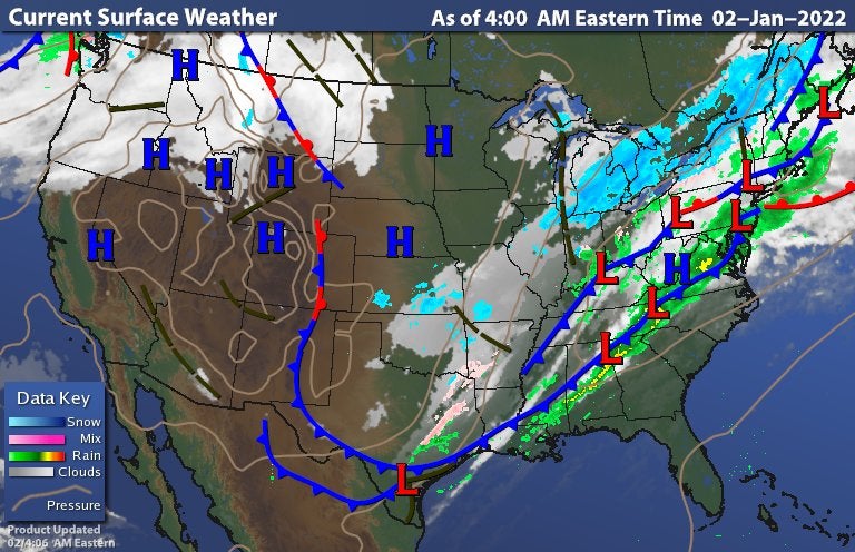
Temperatures will take a nondiurnal curve today meaning, very little warming will occur and brisk NW winds will not help either. You can see the extent of the deepening trough across the nation's heartland in the image below. This is helping in the aid of below normal temperatures for today and tomorrow. Depending on how quickly clouds will clear, we look to drop to Monday morning lows in the teens and wind chills in the single digits. Some modeling data have trended slightly upwards a few degrees the past few runs but overall, it will feel like winter on your skin so be sure to layer up.
Warmer air will briefly be transported back in for Tuesday as we get into the back side of high pressure but not to same magnitude as we got use to seeing during December. This modified version of a warm up will bring us into the 40s which is still above normal for this time of the year, this deep into the winter season. A disturbance to the North associated with the passage of a cold front will bring a few clouds to the area on Wednesday and keep temperatures in check for the afternoon. On it's heels is a shortwave trough the has the potential to bring down some of coldest air of the season to bookend the work week. Still eyeing the potential for snow but it is still too early to get into specifics at this time.
SUNDAY-TUESDAY |
WEDNESDAY |
THURSDAY |
No comments:
Post a Comment